Howe Green to St. Peter's Bridge (old A130)
via Galleywood and Stock
24th May 2023
| Distance |
Time |
Elevation in meters |
Km |
Elapsed
Hrs-Mins |
Moving
Hrs-Mins |
Gain |
Loss |
Min |
Max |
| 28.09 |
7H55 |
5H51 |
247 |
256 |
24 |
98 |
|
|
|
|
|
|
|


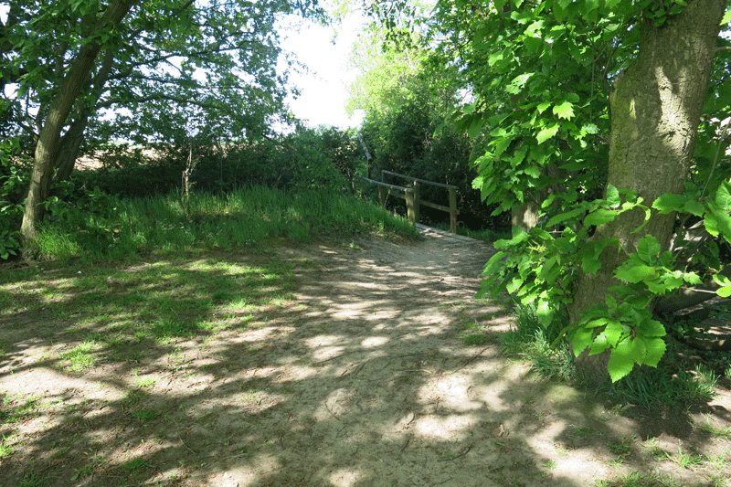
Leaving Howe Green

Down Gingerbread Hill to Junction 17 on the A12

Up the slip road and over the stile. The vegetation has been cut back but the stile is very wobbly!

Heading towards Great Mascalls Farm. How everything has grown!

Great Mascalls Farm

Through the farm and onto the West Hanningfield Road

The path is on the opposite side of the road, down the side of the house.

The heavy scent of the Hawthorne in full blossom

Right turn over the bridge into the adjacent field

Down to the brook.

Heavy growth around the footbridge over the stream

A clear path over the next field to Vicarage Road

.

Down The Chase towards the vineyards

.

.

.

The Vineyard

Right turn towards Galleywood
.

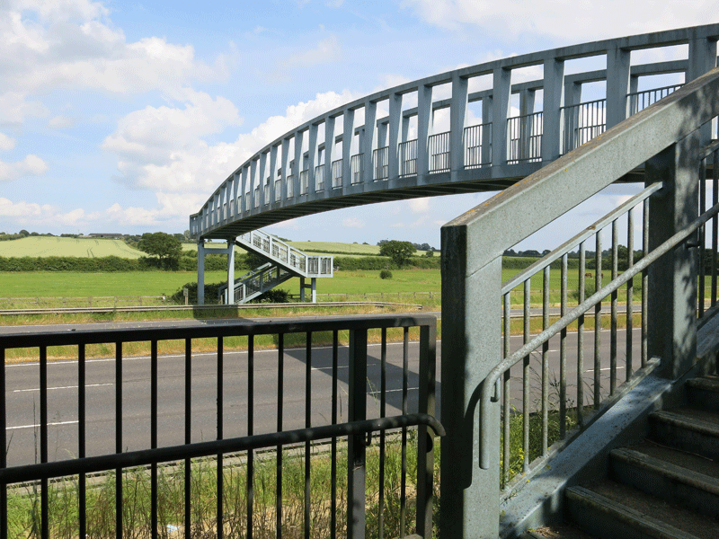
Left turn towards the bridge over the A12

Shady seat at Jubilee Copse; time for a drink and a snack.
(5.60 km 1H15)

Bridge over A12

A12

Right towards Bakers Lane

.

From Bakers Lane, looking back along the route I had taken

Turning right along Bakers Lane

It seems odd initially, but the path goes left through Berkeley Park's "Temple Grove Park".

.

.

.

.

The path skirts the Jehovah Witness's campus on the right

.

The Jehovah Witness's HQ

.

.

From this point, you skirt the edge of the field, and then head straight across the
field (path difficult to see) towards Ship Road.

Turning slightly right there is a finger board in 20 yards pointing across the field towards
lower Stock Road. Normally this footpath is visible, but it was completely hidden by tall rape
seed plants.

The rape was above my head and the pollen was quite strong! All I could do was to fight my way
through in a general heading towards the trees.

There is a "cross road of paths" where you go straight on towards Lower Stock Road

Over the footbridge as you approach Lower Stock Road

Lower Stock Road. Turn left here for a couple of hundred yards before taking a path to the right.

.

The footbridge leading off Lower Stock Road on the section to Steels Farm

The section immediately after the footbridge

Dogleg at Point 2....... make sure you keep to the left of these trees
which leads to the left hand side of the small lake ahead.

If you go to the right of these trees the path eventually links up with the path on
the left, but this is not a right of way and I understand the farmer gets stroppy.

There is a marker post at this dogleg

The path continues until it enters a small wooded area next to the small lake

.

.

.

Small lake

.

.

At the marker post the path swings slightly to the right into the open field

.

.

Turn to the left in the open field

.

This is Point 3, the dogleg to the right leading to Stee's Farm. If you miss this dogleg
and carry straight on, you reach Leatherbottle Hill, Downham Road, but the gap in the
fence has been sealed off with barbed wire!

Left towards Steels Farm

Steels Farm in the distance

.

.

.

.

Stile on to Downham Road, next to Steels Farm

.

At the stile, left goes down the Downham Road, past the point where I encountered
the barbed wire. This road is a bit dangerous due to speeding traffic and there being no
space at the side of the road.

Right of the stile along the Downham Road is Lavender Cottage. There is a path to the left of
Lavender Cottage, part of St. Peter's Way, which leads to Stock Tower Mill.
This is a better way to go as there is less exposure to speeding traffic.

Lavender Cottage. There is a marker post by the telegraph pole.

Lavender Cottage

.

.

.

.

Across the field to Mill Lane

Mill Lane

Mill Lane, heading towards Stock Tower Windmill

Meadowgate

Stock Tower Windmill
(Open to the public 2pm to 5pm on the second Sunday each month April to September)
At the T-junction at the top of Mill Lane, turn left towards Furze Lane

Bench at the T-junction of Furze Lane, my next resting place for a drink and a snack.
(11.27km 3H03)

Down Furze Lane

Left down Broomwood Lane

Right down the Bridleway

.

.

Half way down the bridleway there is a left turn towards Dowsett Lane for a shorter walk

.

Leaving the bridleway into Mill Lane

Left at the main road, and then right down Park Lane

The bottom end of Park Lane where a path starts, dropping down to Ramsden Park Farm under the railway bridge.
Turning left along "millionaires row" you reach the main road where you turn left agai towards the
Fox & Hounds pub, under the railway bridge. After the you cut across the fields towards De Beauvoir House

.

Past the Fox and Hounds pub. An alternative route comes out along the drive of Chase Bungalow,
immediately next to the Fox and Hounds.

De Beauvoir House House; the path goes to the left here, over a stile next to a gate which says "No Entry".
This is The Orchard Farm, but there is a right of way.
(17.65 4H45)

Through Rectotry Wood into a field that leads to Downham

Another bench for a welcome break: St. Margaret's Church is just visible centre photograph

Downham Pond

Snicket leading off Downham Road towards Hawkswood Road

Gate leading onto Hawkswood Road
(20km 5H25)

Gate leading into Hanningfield Nature Reserve, just opposite Lee View Farm. It is possible to slide past the post
on the right hand side of this gate.

The Cafe at Fisherman's Lodge, Hanningfield Reservoir
(21.48km 5H46)

.

.

Great place for a cup of tea and a piece of cake!

Past the Windmill Pub on the way to West Hanningfield

The long drag along Middlemead, alongside the reservoir

West Hanningfiield. You pick up St. Peter's Way here, either alongside St Peter's School
or up Helmons Lane, a but further on. I prefer going up Helmons Lane.
(25.63km 7H12)

On St Peter's Way, turning right at the top of Helmons Lane just before Helmons Farm

Crossing the fields towards St Peter's Bridge over the new A130
St Peter's Bridge (28.06 7H55)
At this point I could have walked an extra 9 km via East Hanningfield to Howe Green,
but having done 28km on what was a very hot day I decided to call for
the cavalry and have Sue pick me up!
|
